
QNOPY is a turnkey solution. We take care of technology so you can focus on your work. Your subscription includes software + all the required technical support.
Our subscription prices are fixed, but we spend a significant amount of time up front to ensure your digitization initiative is implemented successfully. While it is a risk for us to spend so much time upfront, we believe you will like our platform and continue to grow with us for years to come.
Our services include:
- Building forms and updating them as we get user feedback
- Training your personnel to use the applications
- Creating custom guides and SOPs
- Answering phone calls and providing technical support
- Helping set up projects and configuring forms
For the sake of understanding the cost benefits of QNOPY let’s assume an enterprise account with 200 users over a period of 24 months.
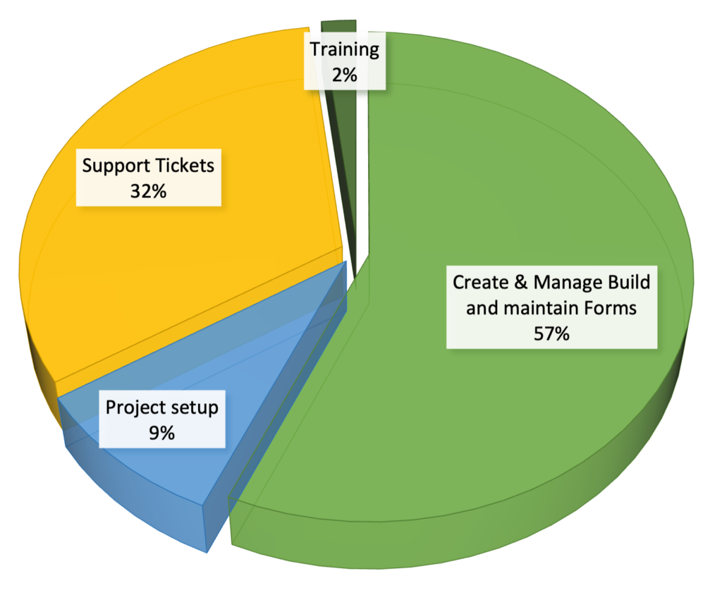
The following table shows the typical numbers of support hours:
| Year 1 | Year 2 | Average | |
| Build and maintain Forms | 800 | 400 | 600 |
| Project setup | 100 | 100 | 100 |
| Tickets | 400 | 280 | 340 |
| Training | 20 | 20 | 20 |
| Total | 1,320 | 800 | 1,060 |
………………………………………. ………………………………………….
ROI Calculation
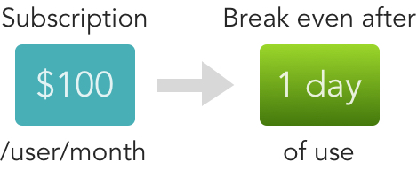
There is almost no comparison when it comes to paper forms vs. QNOPY. With our volume discount you will break even with just 7 days of use per year.
Following table shows the typical time in hours it takes to transcribe field data from one single day’s of field notes collected on paper forms:
| Common field work | Hours to transcribe notes per day | Billing Rate | Total Cost per person per day |
| Groundwater sampling | 2.5 | $120 | $300 |
| Soil boring logs | 4 | $120 | $480 |
| Daily logs | 2 | $120 | $240 |
| EHS inspections | 4 | $120 | $480 |
| Photo logs | 3 | $120 | $360 |
………………………………………. ………………………………………….
Built for Environmental
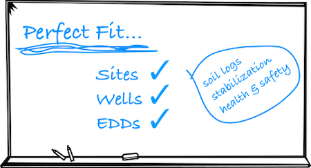
QNOPY’s Application design perfectly fits for environmental projects. It’s not a generic form builder application that you can rig to record and store environmental field data. The hierarchy of the table structure mimics the physical project structure – Project – Locations – Forms – Sampling events.
There are a ton of features and unique flows required to make field data collection seamless, such as stabilization calculations, groundwater elevation calculations, totalizer readings, warning levels, comparing with historic ranges, etc. that are part of the QNOPY application which other generic application do not have.
Want to give it a try?