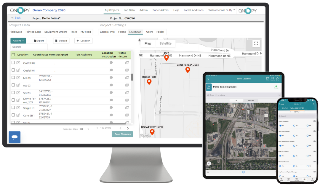
Unlock SUPER FIELD EFFICIENCY
Streamline and Enhance your Field Data Collection
Our mobile field data collection app is intuitive and fast – making fieldwork efficient and enjoyable. With a sleek, user-friendly interface packed with useful features, your field team will be quick to adopt a digital workflow.

Mobile Field Data Collection App
Where’s the Value?
QNOPY is the only field data collection app and platform to provide unlimited storage, customizability, and support for any project…
01
Ultra User-Friendly
Built for user adoption, we’ve made our mobile field app the most user-friendly on the market. Easily and quickly log field data – and enjoy doing it!
02
Unlimited 24/7 Support
Have questions in the field? Our team of seasoned professionals brings unmatched expertise to every project.
03
Endless Customization
According to your requirements, we build your field forms. Want drop downs, pre-populated fields, data validations, or automatic calculations? We’ve got you covered.
1,000,000+
Field photos taken
5,400+
Ongoing Projects
7 Countries
Worldwide
24/7
Support and Maintenance
Purpose-built for Environmental and Construction Fieldwork
Our team has over 10 years of experience with fieldwork operations and understand the nuanced requirements of every project – helping you stay efficient and compliant.


Features of the Field Data Collection App
Discover groundbreaking features designed to tackle tomorrow’s challenges head-on. Explore innovative solutions shaping the future landscape.
Work Offline
Collect and store data without an internet connection. Sync effortlessly once you’re back online.
Collaborative Data Sharing
Share data and progress updates with your team in real-time. Avoid duplicating work and ensure comprehensive coverage of all sampling points.
Digital Project Folder
Access all your project documents digitally. No more bulky binders or lost paperwork.
GIS Mapping Integration
View and mark field points or wells directly on a map, even offline. Capture and adjust GPS coordinates easily with simple map interactions.
Photo Capture and Markup
Take detailed photos and annotate them directly in the app to add context to your data.
Automated Calculations and Validations
Use built-in formulas to calculate key data points, like water volume based on well depth. Set validation rules based on historical data to ensure data accuracy.
Applications
Soil Boring, Groundwater Monitoring, Daily Field Logs, Health and Safety, Inspector’s Daily Report, System Operation and Maintenance, Seed JSA, LNAPL Recovery, Air Monitoring, Wetland Delineation, and much more including fully customizable data forms.
Words from Our Clients
Testimonials
Hear what our satisfied clients have to say about their experiences with us.
Our team at JACOBS is using the QNOPY app on a major Interstate project for GDOT and could not be happier with the results. Definitely recommended.

Jeff Woodward, Program Manager
Decreased time in the field and time in the office due to a streamlined data capture, QA/QC, and reporting process. The added features of the app have been an important tool for much of our fieldwork.

Josh Calkin, Principal Engineer
The QNOPY App is extremely beneficial to our project team. It allows our team to easily take photos, add descriptions, and a location tag. It definitely sets our team apart.

Ward McDonald, Project Geologist
Want to give it a try?
