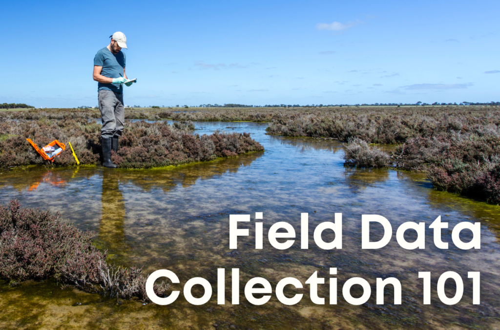
In the fast-paced world of environmental research and development, field data collection acts as the backbone of the industry. Through field data collection, we gather and generate real world insights firsthand, and then provide actionable information to stakeholders. Nonetheless, the nature of field data collection lends itself to be messy, disorganized, and overall a pretty slow paced process.
In 2024 and beyond, firms can prioritize streamlining field data collection through converting from paper field data forms to digital field data forms. Above all, this single improvement allows firms to unlock immense efficiency and profits that have been left on the table.
What is Field Data Collection?
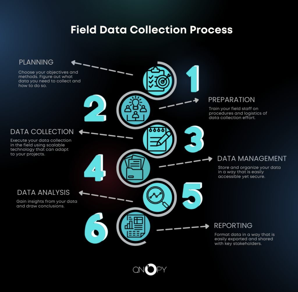
Field data collection refers to the process of gathering raw data directly from its source in an external, often uncontrolled, environment. This method enables field staff to get firsthand information that is pivotal for making informed decisions. In general, the process involves planning, preparation, data collection, data management, data analysis, and reporting.
Here are some of the top positions that frequently engage in field data collection:
Environmental Scientists: These professionals study the natural environment and its interactions with human activities. They collect samples of air, water, soil, and other materials for the purpose of analyzing them for pollutants, biodiversity, and ecological health.
Geologists: They study the Earth’s physical structure and substances, collecting samples in the field to analyze geological formations, mineral deposits, and understand past climatic conditions.
Civil Engineers and Surveyors: Involved in the design and construction of infrastructure projects, they collect topographical and geospatial data for the purpose of planning roads, bridges, and buildings accurately.
Ecologists: Focused on the relationships between organisms and their environments, ecologists gather data in the field to understand ecosystem dynamics, species interactions, and conservation needs.
Agricultural Scientists and Agronomists: These experts examine crop production and soil management. They collect data on soil health, crop performance, and farming practices to improve agricultural productivity and sustainability.
Foresters: Engaged in the management of forested lands, foresters collect data on tree species, forest health, and timber resources to ensure sustainable management practices.
Hydrologists: Specializing in the study of water resources, hydrologists collect data on water quality, flow, and distribution to manage water resources effectively.
Urban Planners and Geographic Information System (GIS) Specialists: Engaged in the planning and development of urban and rural areas, they generally collect spatial data for mapping, zoning, and infrastructure development projects.
Public Health Officials and Epidemiologists: These professionals collect data on health trends, disease outbreaks, and the effectiveness of health interventions in communities to inform public health policies and programs.
Archaeologists: By excavating sites and collecting artifacts, archaeologists gather data to understand human history, culture, and evolution.
Wildlife Biologists and Conservationists: Focused on studying animals in their natural habitats, these experts collect data on species populations, health, and habitat conditions to then inform conservation efforts.
Market Researchers: These professionals gather data directly from consumers and markets to understand trends, preferences, and behaviors, aiding in product development and marketing strategies.
Disaster Management Specialists: They collect data on the ground following natural disasters or emergencies to assess damage, understand the impact on communities, and coordinate response efforts.
Climatologists and Meteorologists: They gather atmospheric data for the purpose of understanding weather patterns, climate change, and its effects on the environment.
Tools and Techniques for Effective Data Collection
Effective field data collection relies on a variety of tools and techniques to gather accurate and reliable data. Here’s a list of some of the most widely used tools and techniques:
Tools for Field Data Collection
Handheld GPS Devices: Essential for accurate location tracking and mapping in the field, thus enabling precise data collection points.
Mobile Devices and Tablets: Used with specialized apps for data entry, surveys, capturing photos, and recording observations in real-time.
Drones (Unmanned Aerial Vehicles): Provide aerial photography and videography, useful for mapping, surveying land, agricultural monitoring, and environmental observations.
Sampling Equipment: Such as soil corers, water sampling bottles, and air quality monitors, tailored to specific types of environmental samples.
Environmental Sensors: Deployed to measure parameters such as temperature, humidity, air quality, and water quality.
Digital Cameras and Binoculars: For documentation, observation, and detailed examination of sites, species, and artifacts.
Survey Equipment: Including total stations, theodolites, and laser rangefinders for precise measurements in surveying and construction.
Geographic Information System (GIS) Software: For the purpose of mapping, spatial analysis, and visualization of geographic data.
Techniques for Field Data Collection
Sampling: Selecting a representative subset of a larger population or area for detailed study. Sampling is in fact crucial in environmental science and market research.
Experimental and Field Trials: Manipulating variables in a natural setting to observe outcomes, used in ecology, agriculture, and social sciences.
Remote Sensing: Using satellite or aerial imagery to collect data about the Earth’s surface, useful in geography and environmental studies.
Photographic and Video Documentation: Capturing images and footage for analysis and record-keeping.
These tools and techniques can be used in isolation or combined to enhance the depth of data collection efforts. It all depends on the specific requirements of each project or study.
Challenges in Field Data Collection
Despite its significance, field data collection has its challenges. From environmental obstacles and data quality concerns to technological issues and logistical complexities. Recognizing and addressing these challenges is essential for the success of any field data project. One of the best ways to ensure data is captured efficiently is to use digital field data collection software rather than paper forms.
QNOPY: Your Solution for Digitizing Field Data Collection
QNOPY offers a comprehensive solution designed to simplify the complexities of environmental and construction field data collection. By leveraging advanced mobile and cloud technologies, QNOPY enhances the efficiency and accuracy of data gathering. Furthermore, we have over a decade of experience in the environmental, engineering, and construction industries. Therefore, you can rest assured that you’e working with a team that understands your unique technical problems in the field.
Key Features of QNOPY
- Customizable Mobile Forms: QNOPY’s platform allows you to create tailored forms using an easy-to-use interface. Move away from paper forms and towards a digital approach that minimizes errors and accelerates data collection.
- Real-time Data Synchronization: Data collected in the field is instantly synced, making it immediately available for analysis. This real-time feature facilitates quick decision-making and efficient project management.
- Offline Data Collection Capability: QNOPY ensures that data collection is not hindered by lack of internet connectivity. Data gathered offline is automatically synced when a connection is available, making it ideal for remote locations.
- Data Integrity and Compliance: With standardized forms and automated checks, QNOPY ensures the accuracy and integrity of your data, meeting regulatory compliance requirements and supporting reliable analysis.