
How do you upload, organize, and share your field photos? For many, the process is time consuming and inefficient. It involves sending photos to and from multiple devices, resizing and formatting, and manually adding notes to every photo. QNOPY offers a robust solution for photo logging, streamlining the process of integrating visual data with field notes. Let’s explore the features of QNOPY’s cutting-edge photo logging tool.
Key Features of QNOPY’s Photo Digitization
Automatic Metadata Tagging:
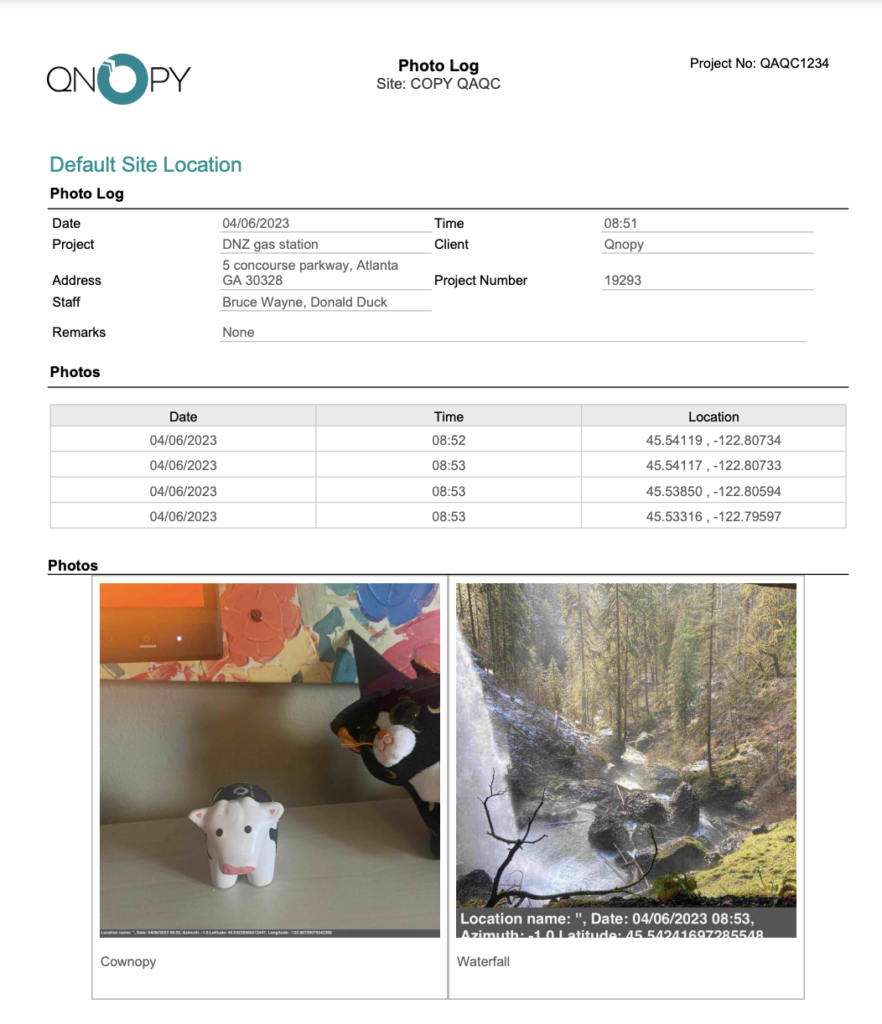
With the app, users are able to take a photo at any point during their data collection. Each photo captured via QNOPY automatically logs essential information eliminating the need for manual input, ensuring accurate and complete data capture.
With each photo, the following information is automatically included:
- The location of the photo
- The date and time of the photo
- Who took the photo
- Any drawings or edits made to the photo
- The ability to view the photo on a satellite map
- The form the photo applies to
- Captions added to the photo
Integrated Photo Editing and Annotations:
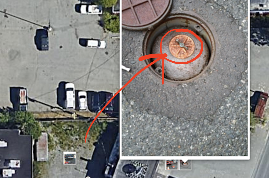
This functionality enables users to directly edit photos within the app, thus enhancing the clarity and utility of each image. Users have the ability to draw on photos, add various shapes, and insert captions. These features significantly aid in providing immediate clarification and emphasis on specific aspects of the captured images.
This in-app editing tool is intuitive and easy to use, allowing field professionals to annotate photos on-the-go. The drawing tool can highlight specific features in a photo, such as pointing out an area of concern in an environmental site or tracing the path of a particular feature.
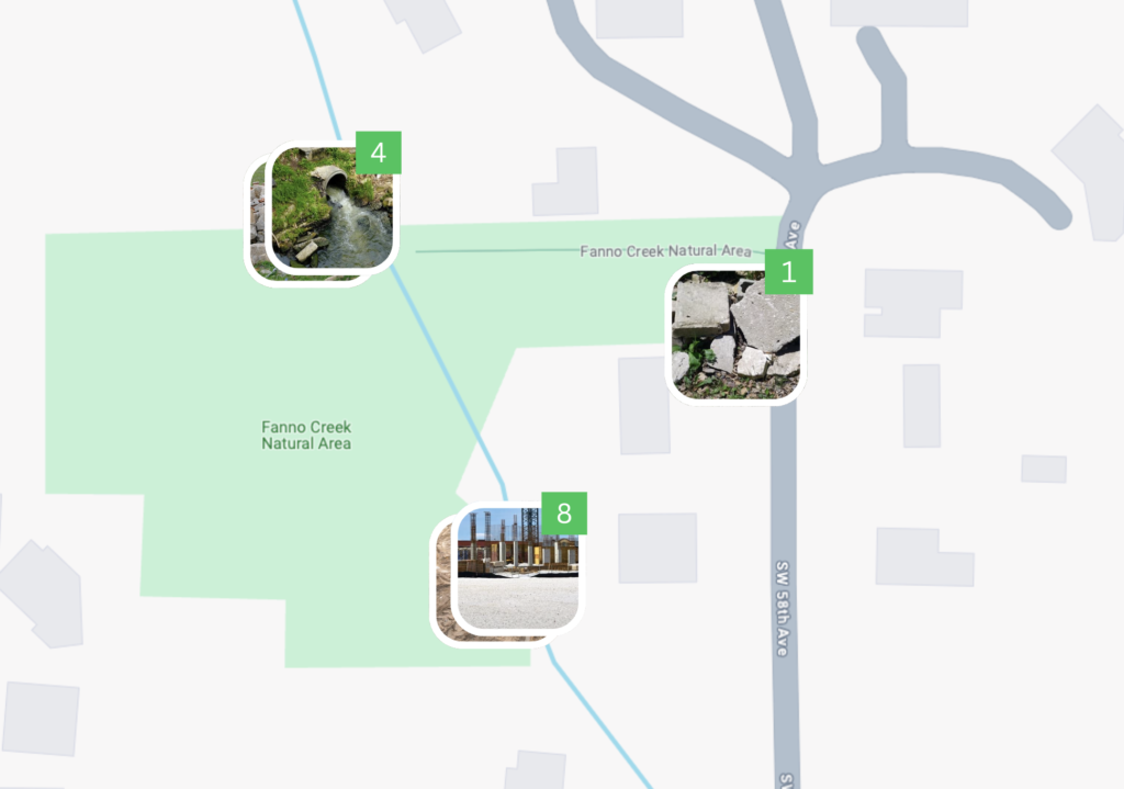
View Photos on Satellite Maps
This feature allows users to view photographs directly in the context of their geographical location, overlaid on a detailed satellite or flat map. This integration provides a clear and comprehensive spatial understanding of the site, thus enhancing your ability to analyze and interpret environmental conditions and changes.
When a user uploads a photo to the QNOPY system, the application automatically geotags it with precise GPS coordinates. These photos are then displayed on a satellite map, which can be zoomed in and out for varying levels of detail. This mapping capability allows users to see exactly where each photo was taken, making it easier to correlate visual data with specific locations on the site.
Seamless Integration with Reports:
Photos are automatically saved in the QNOPY system and can be easily included in reports. View photos separately in different formats, like tabular or map view, for better organization and analysis. You can also create your own custom format for photo exports that automatically sizes photos correctly and includes relevant data.
Flexible Upload Options:
Easily upload photos taken outside the QNOPY app from the user’s gallery, ensuring that all relevant images appear in the project documentation. Just click the “gallery” navigation button and then select the photos you wish to upload from your device.
Web Interface for Additional Editing:
The web interface of the QNOPY platform enhances the functionality of its Mobile App by offering users advanced features for managing photo documentation. This interface allows for the reordering of photos and the editing of photo captions, giving users additional control over the presentation of visual data in their reports.
Comprehensive Attachment Gallery:
QNOPY’s capabilities extend to more than just photos. Users can also upload and annotate other important project documents like maps and site documents, creating a complete and integrated digital record of all visual data.

With the QNOPY app, you not only get the most user-friendly field data management solution for your environmental or construction projects, you also get a built-in photo digitization tool offering helpful time-saving features that streamline the process of photo capture, editing, and integration into project reports.
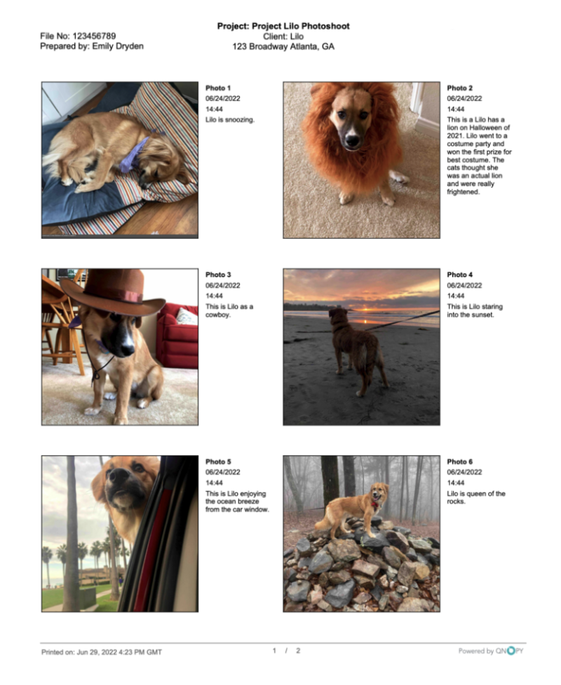
Finally, here is a custom photo report featuring pups of QNOPY – just one of many use cases for photo logging!