Some basic GIS features in the QNOPY Mobile App can help you streamline your field work, whether you are sampling groundwater or installing soil borings and monitoring wells. These GIS features work offline- you can view, add, or update points in the app.
View locations on a map
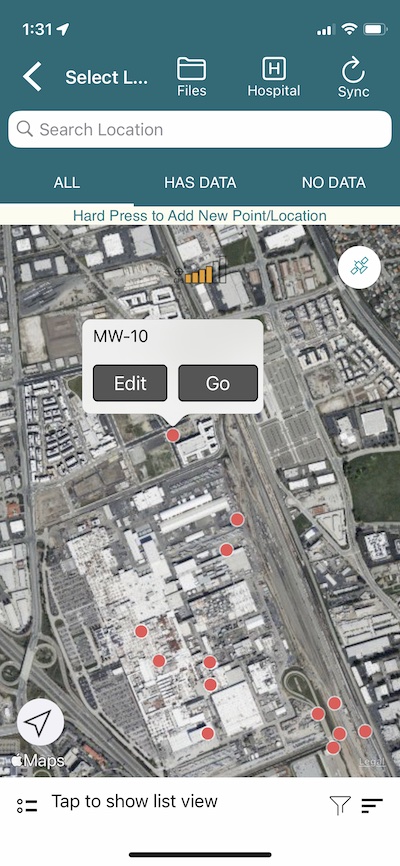
The QNOPY Mobile App lets you view and move your monitoring points, or Locations, on a map. A map view makes it particularly easy to find your groundwater monitoring wells or other points you are inspecting. You can see your location and can find nearby points. Location floats indicate whether a location has coordinates in the system or not.
QNOPY color codes location markers on the map, for example, locations that have field data in the App show up green.
You can add new points or locations in the field by simply hard pressing anywhere on the map. This is useful when you are adding offset boring locations or marking soil or air sampling locations on a map.
Capture coordinates for an un-surveyed location
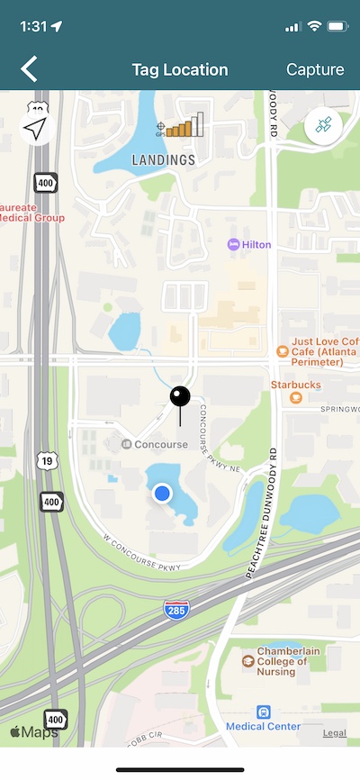
If you have not yet surveyed your monitoring well, no problem, you can capture the coordinates for it by placing it on the map. Tap on the grey location icon and it would bring you to a map with a pin in the middle. You can move the map around, pinch in or pinch out, to set it at a point you want and hit save. Location capture works just like Uber or Lyft.
You can also update existing coordinates by doing the same.
Coordinates get sent to the server next time you Sync your app.